
Scenic Places Suggestions
Press the + to expand
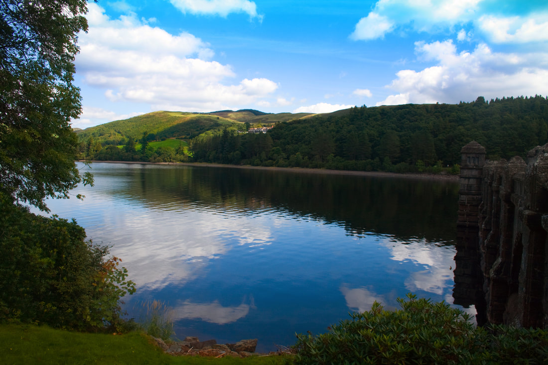
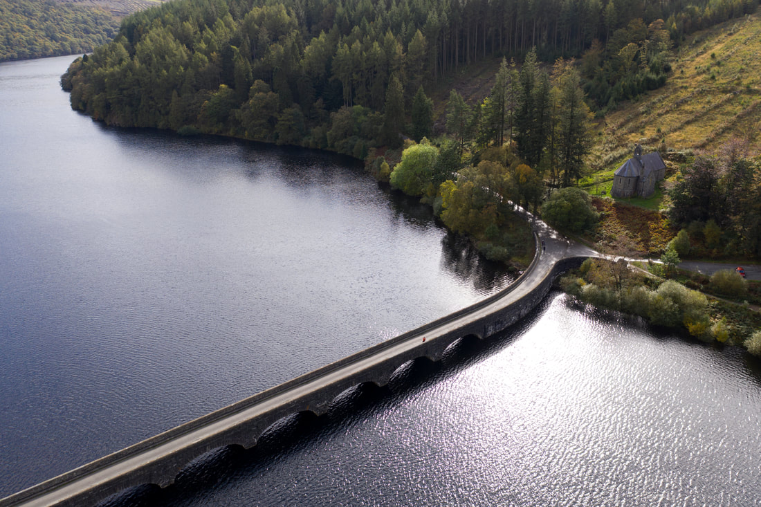
Llyn Clywedog reserve & dam (21 Miles)
The Llyn Clywedog is a man made reservoir formed by the construction of the Clywedog Dam. The lake has a surface area of 615 acres (230 football pitches), is 216 ft deep at its maximum depth and stretches in all a distance of some six miles.
At its maximum, it is just 500 yards wide. Some 15 miles of new or improved roads were built around the reservoir and a number of viewing points and picnic areas are arranged along the circular drive around the lake enabling visitor to enjoy the wonderful panoramic views.
There is a second, much less visible dam at Bwlch-y-gle. This is an earthen structure faced with stone, about 40ft high and 600ft long which prevents the lake spilling over into the neighbouring valleys on either side of Bryn y Fan hill, the highest of the hills surrounding the lake and a commanding feature to be seen from miles around.
WALKING TRAILS
Llyn Clywedog has two marked trails which highlights the breathtaking scenery and stunning views of the dam itself. Around the Lake there are a number of walks including the Clywedog Gorge Trail around the Bryn Tail Mine workings and the Llyn Clywedog Scenic Trail.The National Trail of Glyndwr's Way also passes beneath the dam before pursuing a course along the southern shore of the lake.
WILDLIFE | BIRDWATCHING
Llyn Clywedog provides a perfect habitat for wildlife. Buzzards and Red Kite are now a common sight, and recently there have even been occasional sightings of Ospreys. Mallard are attracted to the lake, while Tawney Owls, Pied Flycatchers and a whole host of Tits have established themselves in the woods bordering the shore.
FISHING
The lake is amply stocked with brown and rainbow trout. The management and fishing rights are the preserve of the Llanidloes Angling Society.
SAILING
Sailing on the lake is run by the Clywedog Sailing Club. Both organisations hold numerous competitions and regattas throughout the year and visitors are always welcome.
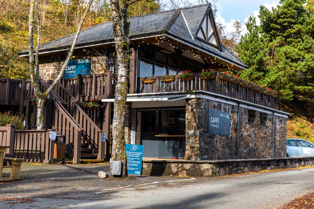
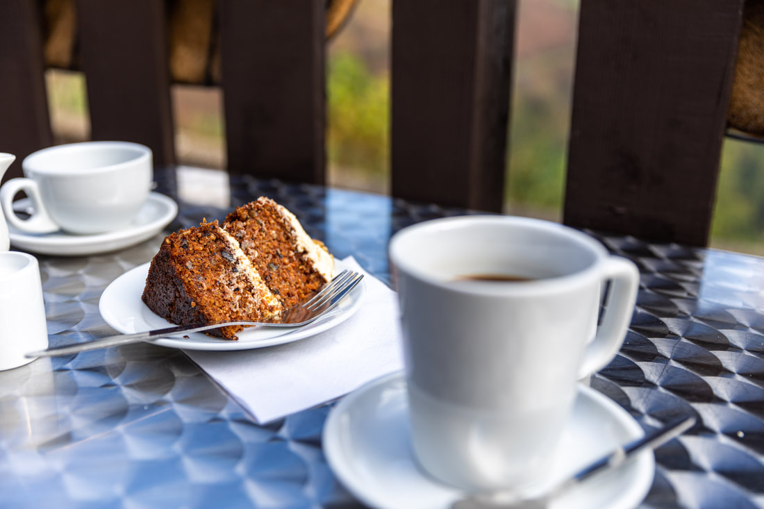
Caffi Clywedog
Caffi Clywedog serves natural, home cooked food that's packed full of goodness. Our food is carefully planned so we are as sustainable and environmentally friendly as possible. Our plant based menu is bursting with flavour and offers a wide range of selection to suit any appetite.
From April 1st 2021, we will be open for takeaways only, which includes tea, coffee, cake and ice-cream. Our main menu will be launching very soon.
cafficlywedog.co.uk/
From April 1st 2021, we will be open for takeaways only, which includes tea, coffee, cake and ice-cream. Our main menu will be launching very soon.
cafficlywedog.co.uk/

Lake Vyrnwy (29 Miles)
Get back to nature and experience the walks, trails and abundance of wildlife.
Pick a viewpoint around the Lake to observe the amazing variety of birds and scenery. With its woodland, moorland and farmland, Lake Vyrnwy has become an internationally important nature reserve for wildlife and habitats. It has so little light pollution that it is one of the best locations to stargaze in the UK.
Lake Vyrnwy has been designated as a Site of Special Scientific Interest (SSSI) as well as a Natura 2000 site.
Although the hillside makes for difficult terrain, one of the hides in the nature reserve is accessible by wheelchair. There's plenty for children too, including nestbox trails and bat and owl walks. Hire a back-pack and go on a creepy-crawly search; hire binoculars as you play bird bingo around the reserve; solve the clues on the animal puzzle trail or explore the Wild Play Park to have fun and get muddy in the Mud Kitchen.


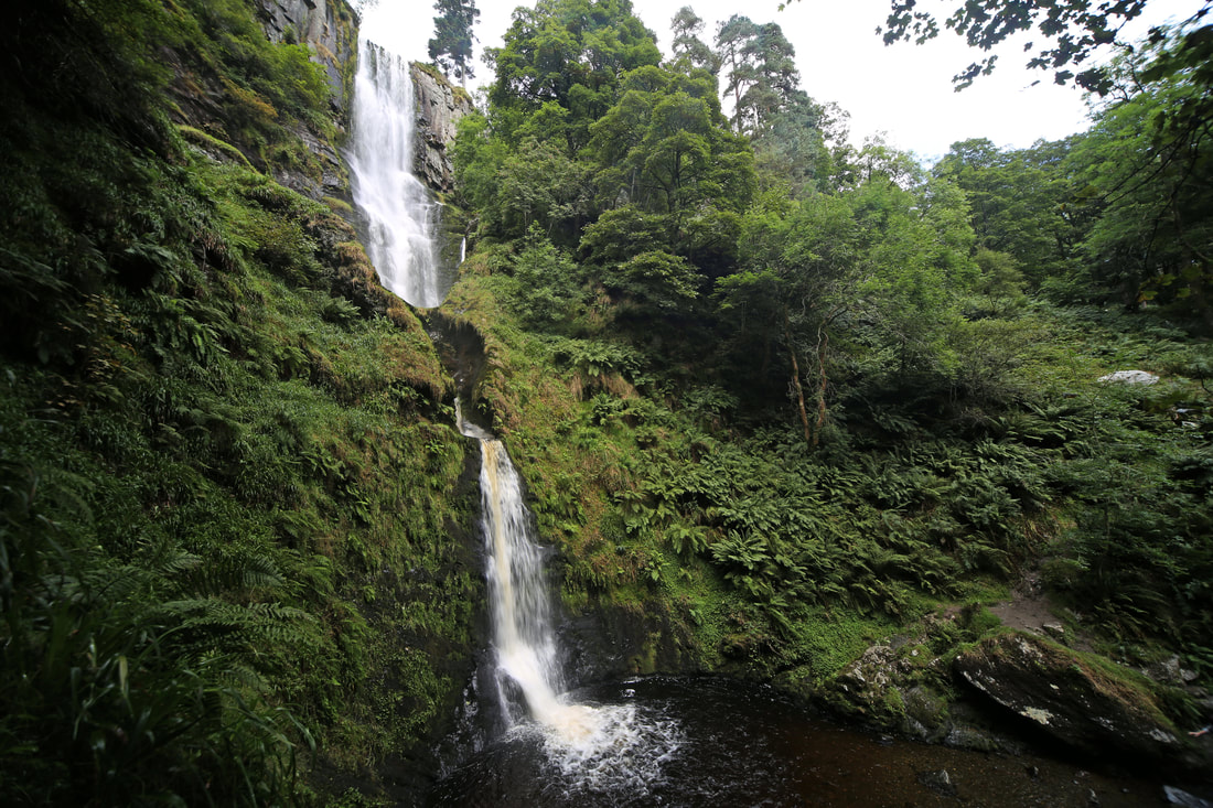
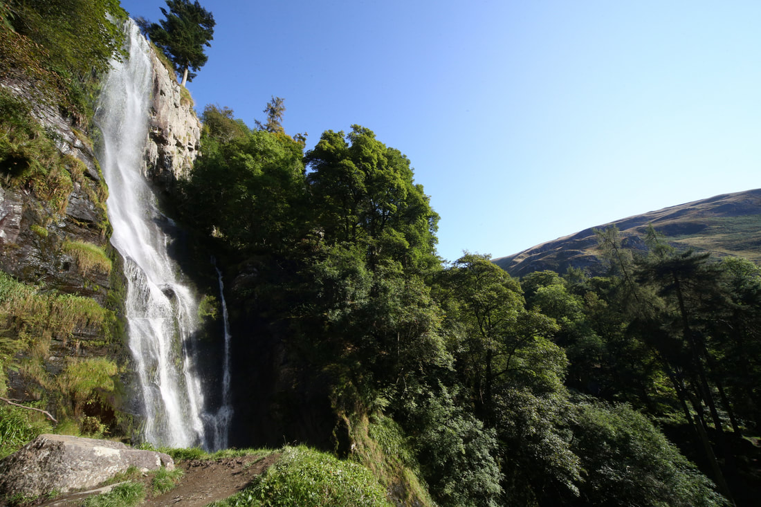
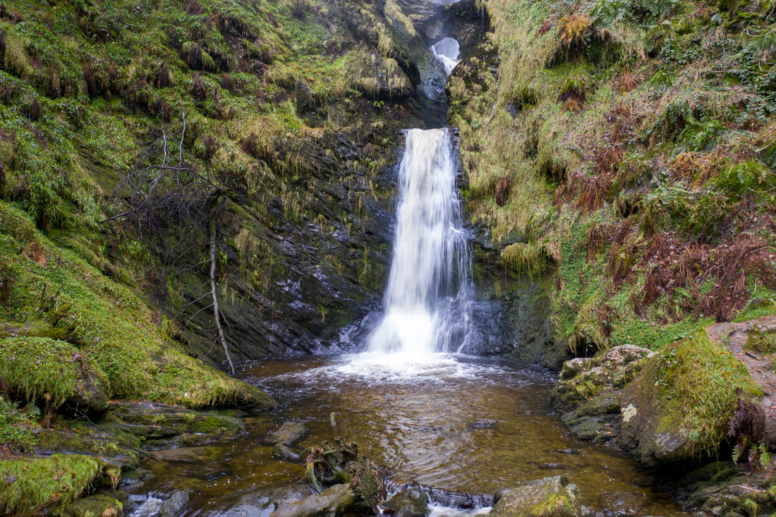
Pistyll Rhaeadr Waterfall (34 Miles)
Pistyll Rhaeadr is often referred to as one of the Seven Wonders of Wales. The waterfall is formed by the Afon Disgynfa falling in three stages over a 240-foot cliff-face, into the Afon Rhaeadr below. The tallest stage is estimated at about 40 metres.
For visitors, there is a small car park at the foot of the waterfall as well as a small café and it is a great place to explore the Berwyn Mountains (Berwyn comes from the Old Welsh ”bre”(hill) and ”gwyn”(shining white) and surrounding hills, with many walks on all levels to suit a variety of walkers.
A 3-mile circuit crosses the foot of the fall and returns to the car park via old quarry heaps and hillsides. A much more adventurous alternative climbs steeply on the right of the waterfall and continues uphill, as far as you want to go along the great cliffs of the Berwyn ridge.
Local Legend - Gwybr of Llanrhaeadr
Above the waterfall is a lake called Llyn Luncaws. The story goes that in this lake lived a serpent with wings who, once every few days, would fly down the valley to the village and there seize children, women or animals, taking them back to the lake to devour them.
Tan-y-Pistyll – meaning little house under the waterfall is where the tea room is located, here we can supply a welcome cup of tea, snack or meal with a lovely view of the waterfall from the outside garden seating, or when its colder a warm log fire to sit by.
The 19th century author George Borrow, in his book Wild Wales, remarked of the waterfall: "What shall I liken it to? I scarcely know, unless it is to an immense skein of silk agitated and disturbed by tempestuous blasts, or to the long tail of a grey courser at furious speed. I never saw water falling so gracefully, so much like thin, beautiful threads as here."
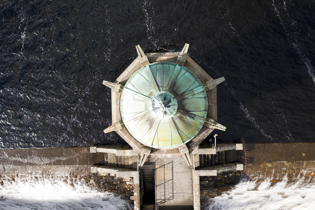
Elan Valley - Reservoirs & Dams (31 miles)
RESERVOIRS AND DAMSThe dams, reservoirs and 73 mile aqueduct of the Elan Valley were built a hundred years ago to supply desperately needed clean water to Birmingham. It was an epic feat of civil engineering set within an area of outstanding scenic beauty.
Today, the dams and reservoirs provide a lasting amenity in their own right for visitors to enjoy as well as safeguarding the natural habitats of numerous species of flora and fauna.
Today, the dams and reservoirs provide a lasting amenity in their own right for visitors to enjoy as well as safeguarding the natural habitats of numerous species of flora and fauna.

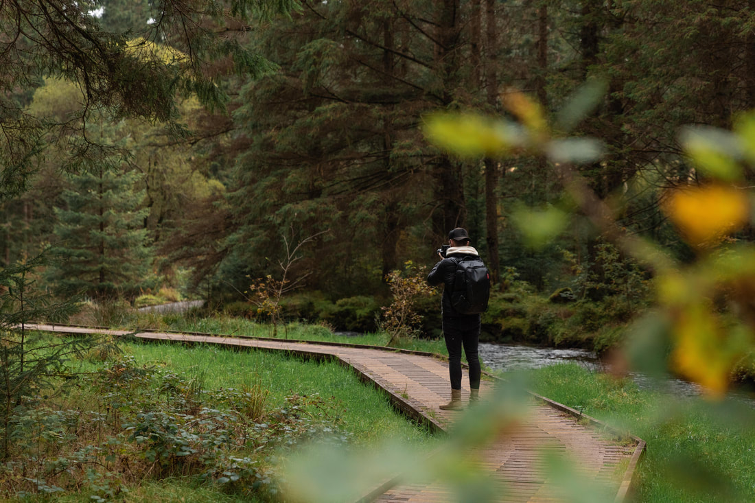
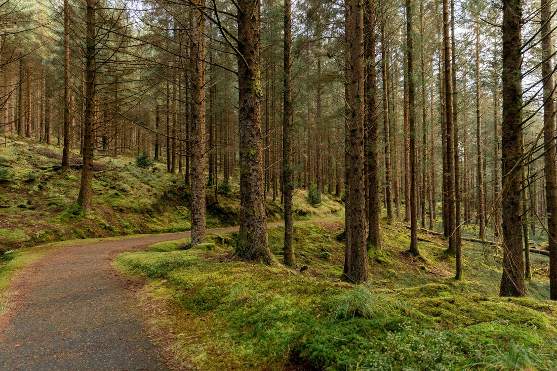
Hafren Forest (24 Miles)
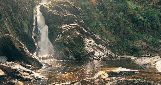
Hafren Forest sits on the edge of the Cambrian Mountains, 7 miles west of the market town of Llanidloes. There are plenty of waterfalls along the river’s way through the forest. Hafren Forest covers 15 square miles and was planted in 1937 - it's a peaceful spot today but before the trees were planted, it was home to lead and tin mining industries.
Walk to the source of the River Severn - or choose from numerous walks including waterfalls. Blaenhafren Falls is the first waterfall on the mighty River Severn as it starts its long journey to the sea. The 7 mile long Source of the Severn Trail leads through the forest to the Severn’s source on Pumlunom, the highest mountain in Mid Wales. The footpath goes up the side of Blaenhafren Falls to the falls.
OS Grid Reference: SN 857 869.
There are several shorter waymarked trails from the car park. The 3 mile Blaenhafren Falls Trail is a scenic route through the forest and past the foot of the falls. A shorter walking trail goes through a meadow and crosses a foot bridge where the River Severn thunders down a gully into the famous Severn Break its Neck waterfall. There is also an all-ability trail with a boardwalk along the riverbank to a viewing area overlooking the Cascade Falls.
For long-distance walkers Hafren Forest is the start (or end) point for two long distance, linear walks - The Wye Valley Walk and The Severn Way and small sections of the Glyndwr's Way National Trail pass through the eastern edge of the forest. For cyclists, the Sustrans Cycle Route 8 between Cardiff and Holyhead passes through Hafren Forest.

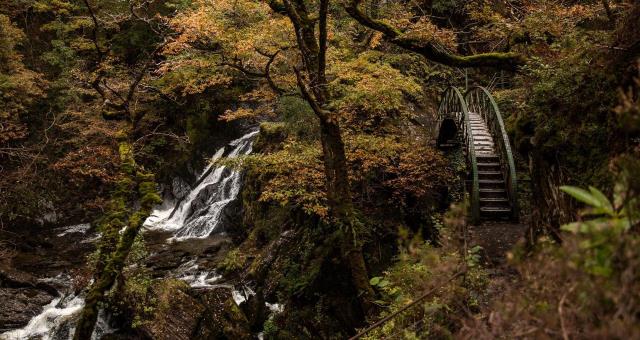
Devils Bridge Waterfall (34 Miles)
Devil's Bridge Falls is a spectacular waterfall attraction at Devils Bridge in the heart of the Cambrian Mountains. It is one of the 'Must See' natural features in Wales, located 12 miles inland from the coastal town of Aberystwyth.
The 300ft Mynach Waterfalls are set deep withing the ancient wooded gorge and have attracted many thousands of visitors since the 18th century, including William Wordsworth who wrote about the “Torrent at the Devil’s Bridge”. Today, Devil's Bridge Falls Nature Trail provides a unique opportunity to see this great natural feature in the Mynych (translates as the 'Monks River'), a tributary of the larger Rheidol River, which runs in a deep, wooded valley towards Aberystwyth and the Cardigan Bay coast.
Technically, Devil's Bridge waterfalls can be classified as a segmented or tiered falls with five major drops and intervening cascades add up to a 91 m total drop, which is among the highest in Wales.
The Devil's Bridge Fall Nature Trail take approximately 45 mins and is a circular walk that takes you deep into the wooded gorge with spectacular views of the 300ft Mynach Waterfalls. The shorter '3 Bridges & Punchbowl trail will take approximately 10 minutes. These walks are challenging and consists of many steep steps.
The Nature Trail is within a Site of Special Scientific Interest (S.S.S.I) and is home to many types of mosses and lichens. It is also an excellent example of an ancient Sessile Oak woodland. A guide book indicating interesting aspects of the Nature Trail is on sale at the entrance kiosk when attendant is on duty.
Please note that the Nature Trail Walk is a challenging walk that contains many steep steps and so is not suitable for everyone.and sensible shoes must be worn. All dogs must be kept on the lead and if your dog is large then it may struggle to enter through the turnstile with you. The steep steps are also difficult for dogs with short legs and you may end up having to carry your pet.
Tearooms & Gift shop are at entrance to walks and are open from Mid Spring to October
THE LONG NATURE TRAIL
On the 45 minute nature trail walk you will see the spectacular waterfalls and the view of the 3 bridges, built one on top of the other, which span the breathtaking woodland gorge. Follow in the footsteps of the monks of past, along the path and descend Jacobs Ladder (100 steps). Cross the humped bridge spanning over the Mynach river at the bottom of the waterfalls and begin to ascend the other side of the gorge. Go into Robbers Cave, an old hideout place next to the waterfall.
Whilst catching your breath at the end of your walk, take time to use the Free Viewing Telescope. Enjoy a close up view of the Gyfarllwyd Falls on the Rheidol river, the surrounding woodland and distant Cambrian Mountains or a Red Kite soaring high above. The exit is opposite the Hafod Hotel.
PUNCHBOWL AND THREE BRIDGES NATURE TRAIL
This is a short ten minute walk where you descend down to the river to view the punchbowl. Here you can see how the force of the river Mynach has carved beautiful, large pot holes into the rock. From this view point the Three Bridges built one on top of the other tower overhead and are an awesome sight.
THE LEGEND OF DEVIL'S BRIDGE
According to legend, the original Devil’s Bridge was built by the Devil himself. He constructed the bridge for a little old lady in exchange for her soul, or the soul of the first person to cross....
Use the U-turn box to listen to how the old lady outwitted the Devil to save her cow. Which is how Devils Bridge got it's name. Hear some traditional Welsh harp music or select the information about the history of our area.
Scenic Drives
Scenic drives around Mid Wales
Loading dynamic content (requires javascript)...